Click on the images below to zoom in and view additional pages.
Boundary Stakeout Survey
Marks or monuments the physical position of property corners or lines. It is typically performed when a property owner wishes to install a fence, undertake a landscaping project, or believes their neighbor may be on their property.
Zoning Location Survey
Depicts or notes the position of existing or proposed improvements with respect to applicable municipal setback requirements. The purpose of this type of survey is to enable determination of compliance with said requirements. These surveys are typically conducted for residential properties when the owner wishes to add an addition, a large, detached structure, or a swimming pool to their property.
Property Survey
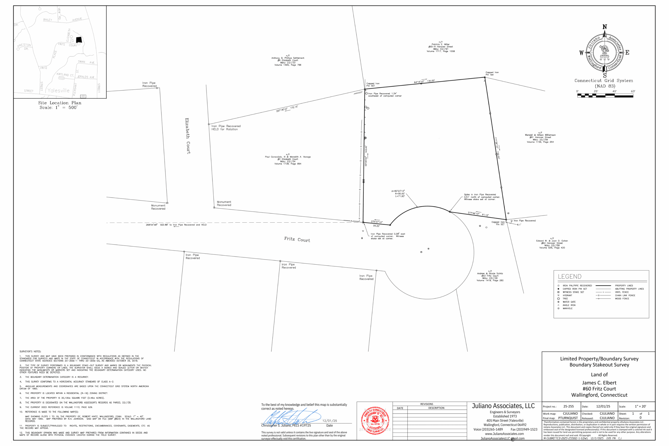
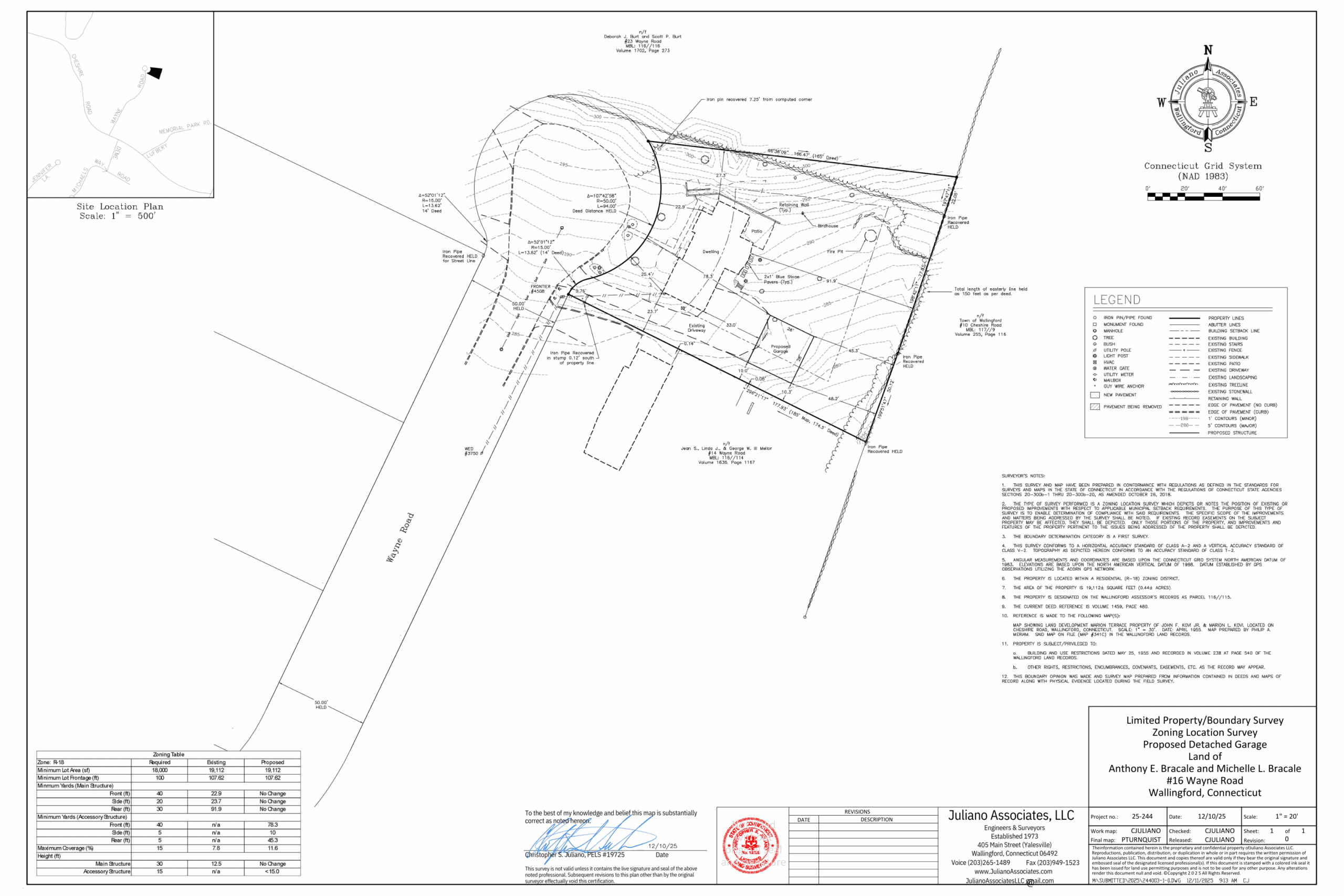
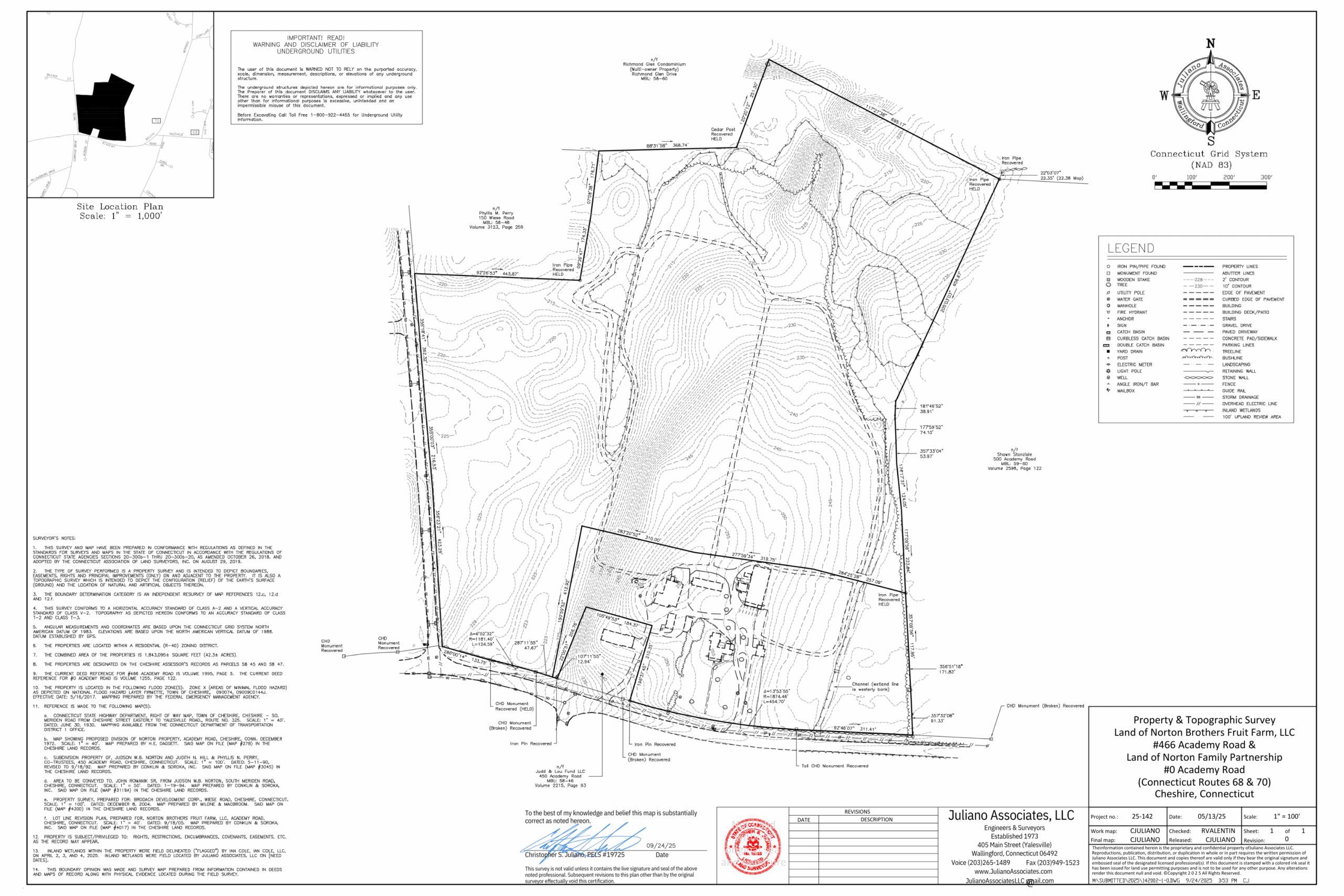
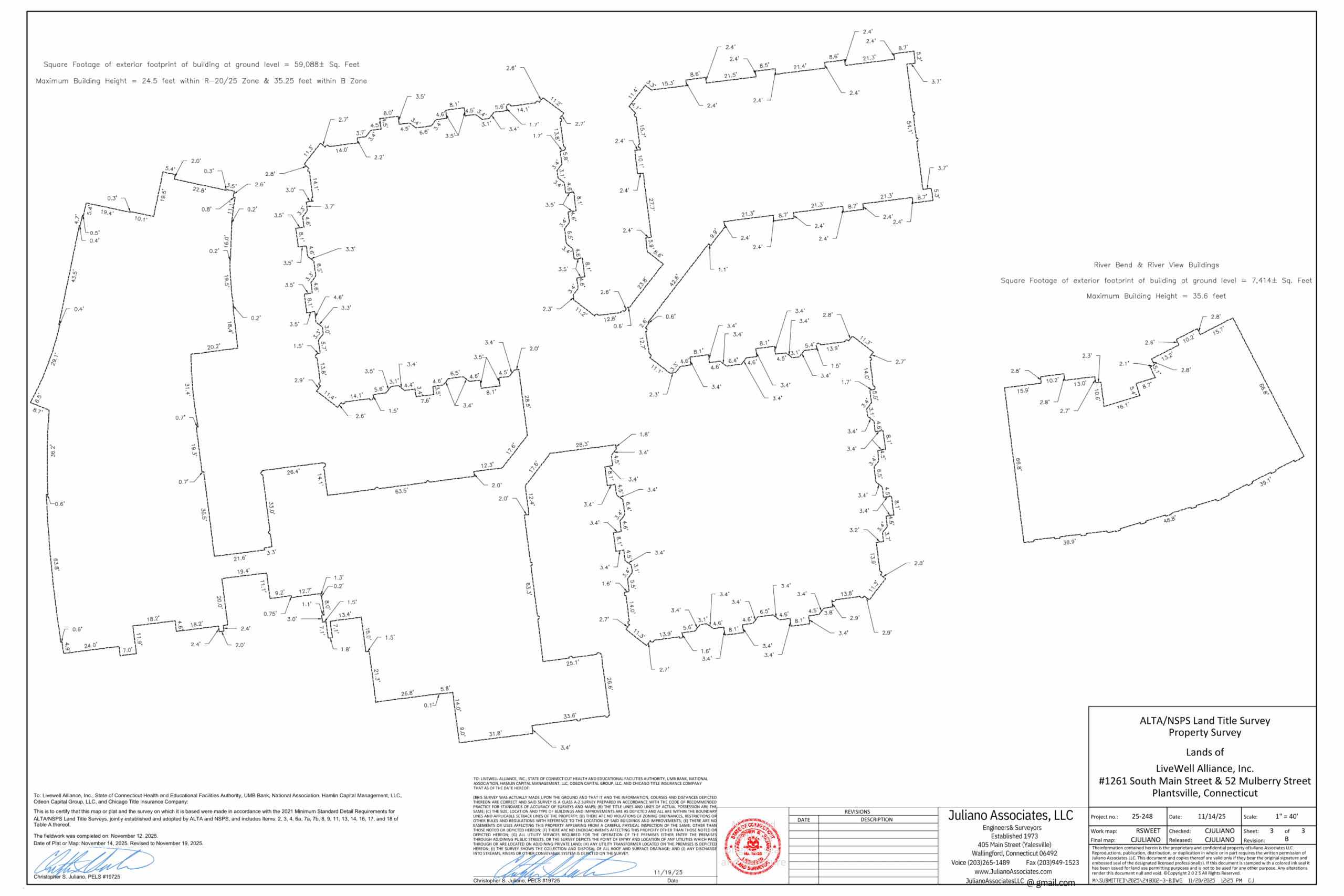
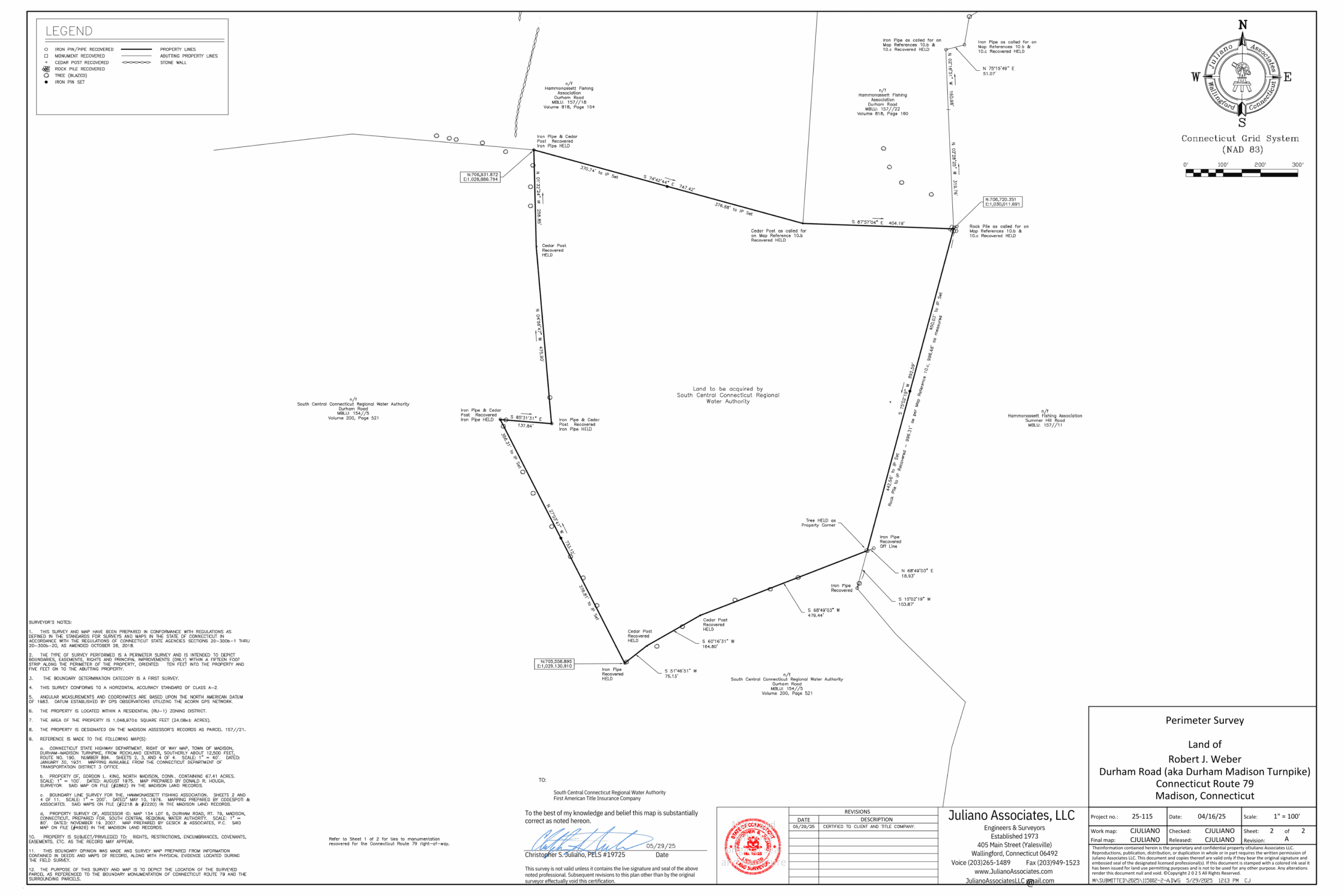
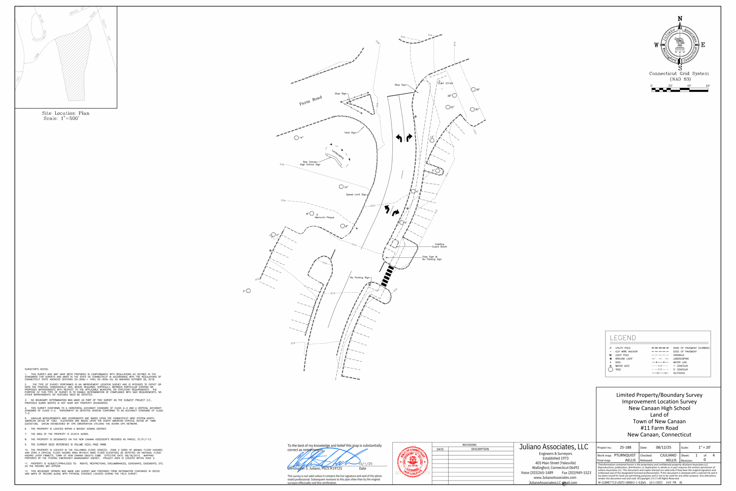
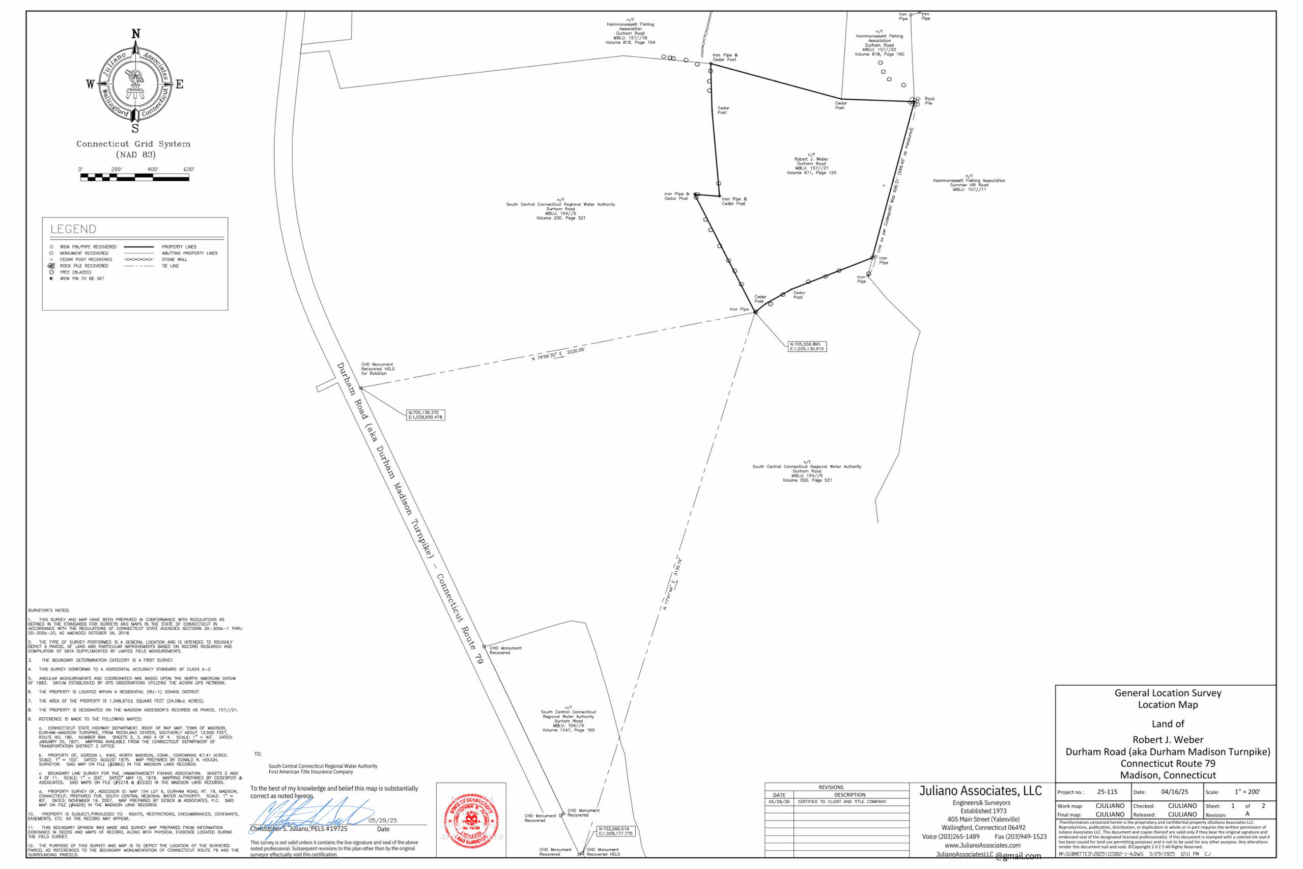
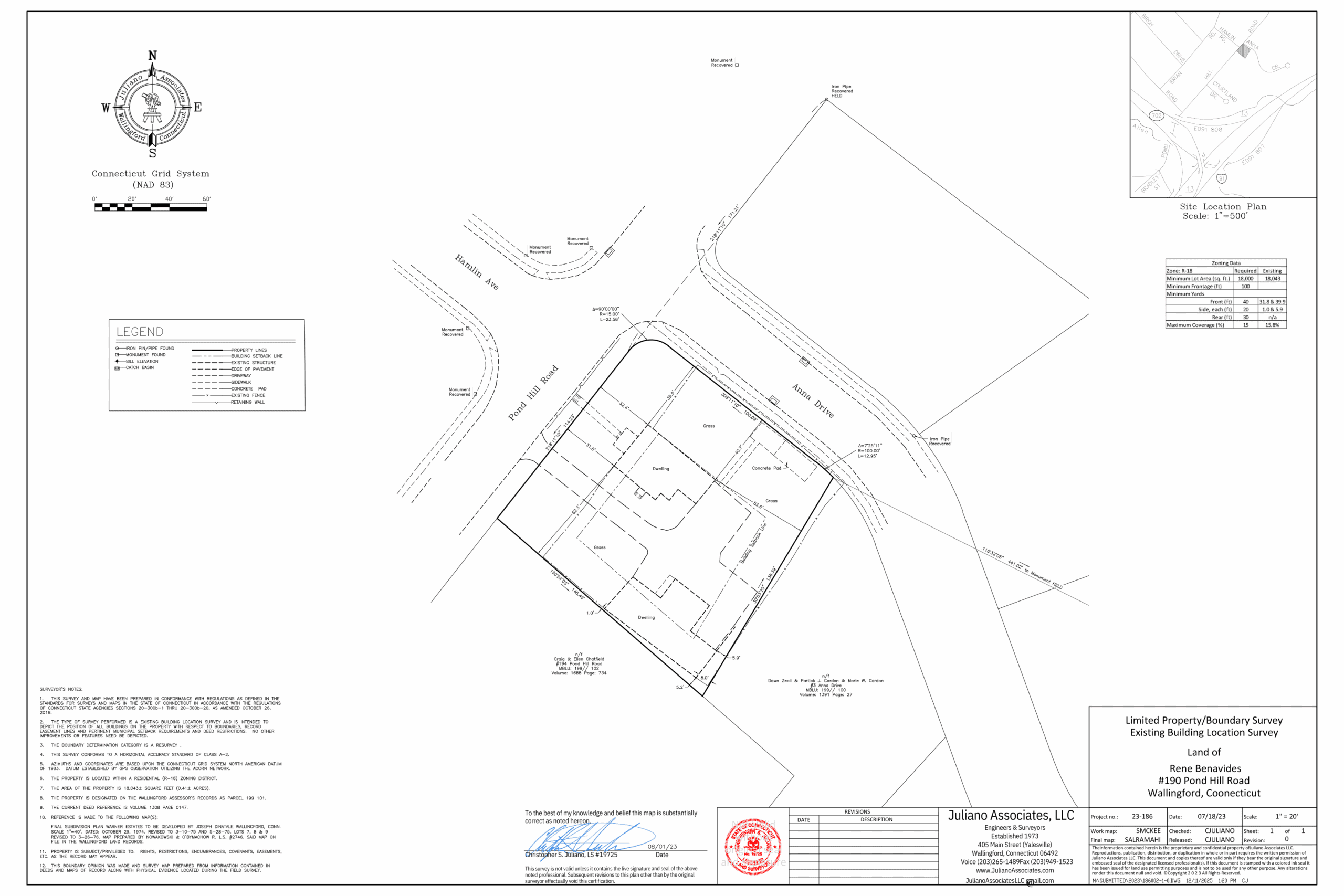
Also sometimes referred to as a boundary survey, legally defines your land’s boundaries, showing property lines, monuments, easements, rights-of-way, encroachments, and improvements (fences, driveways, buildings) according to deed research and state standards (like those from the Connecticut Association of Land Surveyors (CALS)) to resolve discrepancies and ensure compliance with local rules.
ALTA Land Title Survey
A highly detailed property survey following strict national standards set by the American Land Title Association and the National Society of Professional Surveyors (NSPS) to identify boundaries, improvements, easements, and potential risks for commercial real estate and title insurance, providing crucial due diligence for property transactions. It goes beyond a basic survey by documenting all physical features, recorded rights, and potential issues like encroachments or utility locations, helping title insurers issue policies without exceptions and protecting buyers and lenders.
Perimeter Survey
Depict boundaries, easements, rights, and principal improvements (only) within a fifteen-foot strip along the perimeter of the property, oriented ten feet into the property and five feet onto the abutting property. Similar to the Boundary Stakeout Survey, this type of survey is typically utilized for land conveyances or the changing of property lines when said changes would not impact zoning matters.
Improvement Location Survey
An Improvement Location Survey is intended to depict or note the position, horizontally and, where required, vertically, between particular existing or proposed improvements with respect to the applicable municipal or statutory requirements. The purpose of this type of survey is to enable determination of compliance with said requirements. The use of this survey is similar to the Zoning Location Survey; however, it is primarily for commercial or multi-family properties.
Topographic Survey
Depicts the configuration (relief) of the earth’s surface (ground) and the location of natural and artificial objects thereon.
Right-of-Way Survey
Maps the limits of existing or proposed highways or public utility transmission easements, including the mapping of parcels to be acquired for such purpose(s), as referenced to an established baseline.
General Location Survey
Roughly depict a parcel of land and particular improvements based on record research and compilation of data supplemented by limited field measurements.
Existing Building Location Survey
Depict or note the position of all buildings on the property with respect to the boundaries, record easement lines, and pertinent municipal setback requirements and deed restrictions.
Compilation Plan
A plan or map based on land record research and other sources of information which depicts the approximate size and shape of a parcel of land. This plan may be derived from records only and not as a result of a field survey or measurements by the surveyor. The accuracy of this plan may vary with the quality of the data from which it has been compiled.
Elevation Certificates
An Elevation Certificate (EC) is an official Federal Emergency Management Agency (FEMA) document that depicts a building’s elevation relative to the expected flood level, used by insurers to set flood insurance rates, enforce local building codes, and help homeowners potentially lower premiums by proving their property’s flood resistance. It details the structure’s lowest floor, machinery, and ground levels, helping determine flood risk and compliance with National Flood Insurance Program (NFIP) rules, especially for properties in high-risk flood zones.